
Decision Support Tools
Decisions about whether to remove or keep barriers to aquatic connectivity are often contentious, challenging, and time consuming due to the competing needs of restoring commercially and recreationally important species while continuing to block invasive species. Dam removal or restoration can be very expensive, with planning and construction costs often in the millions of dollars.
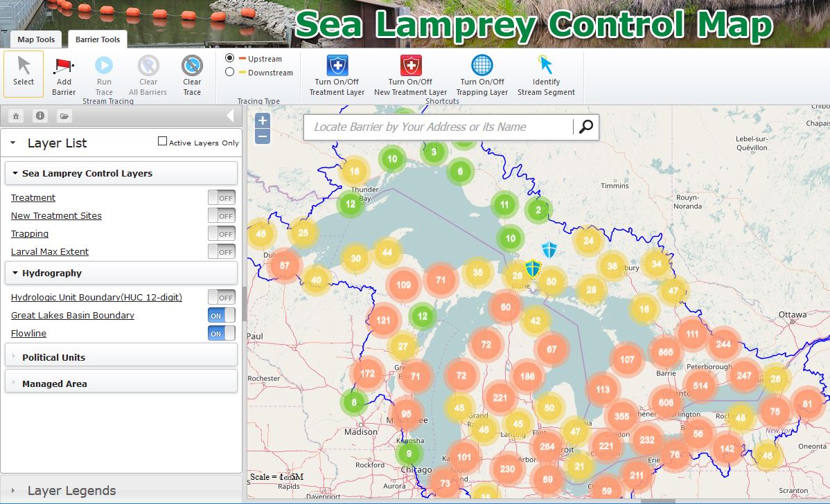
Analytical tools help decision makers visualize barriers and explore tradeoffs of different options through optimization modeling. The Great Lakes Fishery Commission and Great Lakes Commission have developed a Sea Lamprey Barrier Mapping Tool that illustrates barriers critical to sea lamprey control in a web-based mapping application. The tool includes downloadable fact sheets for each barrier; many of the barrier locations have adult sea lamprey catch data from traps that capture adults moving upstream to spawn in spring months. The tool displays an inventory of all Great Lakes dams in the U.S. and Canada, the range of larval sea lamprey infestation in Great Lakes tributaries, and a history of when tributaries have been treated with lampricides. Using simple GIS tools, users can model the impact of adding or removing a barrier, and calculate the number of stream miles that are blocked or opened based on that action.
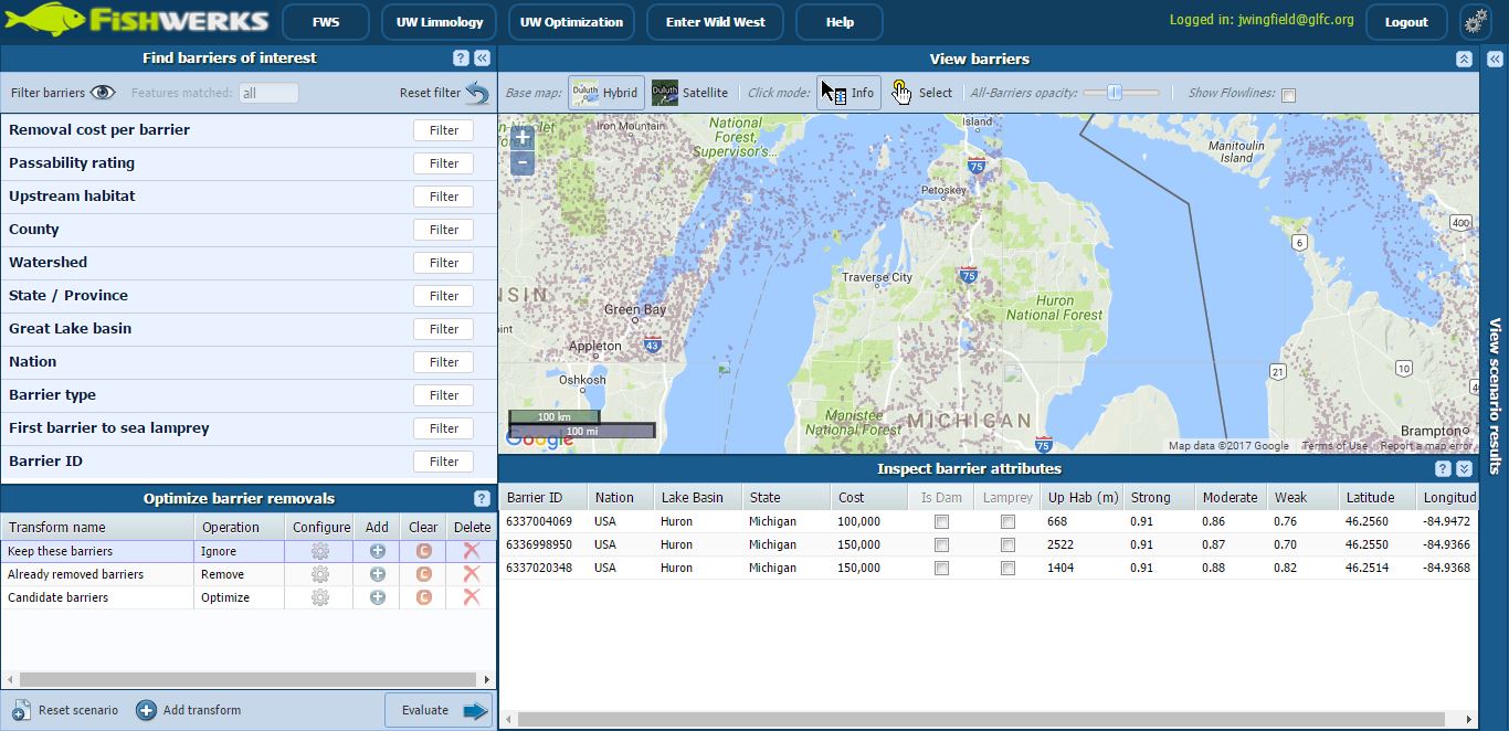
The Great Lakes Fishery Commission has also partnered with a project team based at the University of Wisconsin-Madison to add sea lamprey data into Fishwerks, a web-based GIS platform that allows users to optimize tools that identify barriers which, if removed, would maximize habitat improvements for migratory fish in the Great Lakes Basin. Fishwerks is designed to identify candidate dams and road-stream crossings whose repair or removal would maximize the miles of stream opened for a given budget. The tool can be applied at various scales covering multiple jurisdictions encompassing the entire Great Lakes Basin, so that funding can be optimized on any scale. Developers are continuing to refine the tool, and are adding the ability to estimate the cost of a lampricide treatment should a blocking barrier be removed.